Survey & Detail Project Report
- Home
- Survey & Detail Project Report
Survey
Precision surveying solutions with DGPS And advanced technology
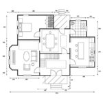
Planning, Design, And Drawings
Specialize in delivering accurate Planning, design, and Drawings
Detail Project Report
Delivering actionable Thorough Documentation and in-depth Analysis of the Projects.
What We Offer

DGPS Surveying
Differential GPS (DGPS) enhances the accuracy of standard GPS systems by correcting signal
errors through ground-based reference stations.
1. High Precision:
2. Real-Time Data
3. Enhanced Reliability
4. Global Coverage:

3D Laser Scanning
Utilize state-of-the-art 3D laser scanning technology to capture detailed and accurate 3D
representations of physical objects and environments.
1. Detailed Data Capture:
2. Rapid Surveying:
3. Versatility
4. complex structures

Total Station Surveying
Precision Surveying Solutions with DGPS and Advanced Technology
1. High Precision Measurements
2. Versatile Applications
3. Efficient Data Collection:
Aerial Survey
Aerial surveying solutions, committed to delivering high-quality data and exceptional service
1. Capture high resolution data
2. Ideal for all projects
3. Provide accurate and timely data

Design and Planning
Specialize in delivering comprehensive and precise Planning, design, and based reference static Drawings
1. Fixing Canal Alignment and structures on canals
2. lift irrigation schemes
3. Pipe distribution network
systems
4 .CADWM works
5. Road alignment, and cross drainage

DETAIL PROJECT REPORT
Delivering the highest standards of report to ensure every project is set up with the correct data and environment for success.
1. Provide essential information and insights
2. A high-level summary of the project
3. Highlight the primary outcomes or results
4. Key recommendations or next steps.
Project complete
years of experience
Serving countrires
Details Project Report Preparation
Precision Surveying Solutions with DGPS and Advanced Technology
Welcome to VTrans, your trusted partner for cutting-edge surveying solutions. We specialize in delivering high-accuracy contour-survey of command area, Canal and road alignment survey, Cross drainage works, Canal structures survey, Lift Irrigation schemes survey, Red Line and Blue Line Surveying for Flood Estimation using Differential GPS (DGPS), and the latest technological advancements in the industry. Whether you're working on the Preparation of Detailed project reports, construction projects, Improvement or Renovation of projects, land development, or environmental studies, our team of experts is equipped to provide precise and reliable data to meet your needs.
Welcome to Our Detail Project Report Preparation Services
At VTrans, we specialize in delivering comprehensive and precise detailed project Reports to meet the highest standards of planning, Designs, Drawings, development, and execution for irrigation projects, lift irrigation schemes, Road Works, and water supply works. Our detailed reports are essential for stakeholders, including agriculturalists, engineers, and environmental planners, Government agencies to ensure every project is set up for success.
Welcome to Our Technical services of Planning, design, and Drawings
At VTrans, we specialize in delivering comprehensive and precise Planning, design, and Drawings for Fixing Canal Alignment and structures on canals, lift irrigation schemes, Pipe distribution network systems, CADWM works, Road alignment, and cross drainage work For precise and cost-efficient Execution of projects.
Welcome to Our Detail Project Report Preparation Services
At VTrans, we specialize in delivering comprehensive and precise detailed project Reports to meet the highest standards of planning, Designs, Drawings, development, and execution for irrigation projects, lift irrigation schemes, Road Works, and water supply works. Our detailed reports are essential for stakeholders, including agriculturalists, engineers, and environmental planners, Government agencies to ensure every project is set up for success.
